Explore Your Watershed

Recreational Access Map
Click on this link to see a map of recreational access opportunities along the Chehalis River and its tributaries. These include parks, places to swim, places to fish, hiking and camping locations, and more!
Washington State Parks in the Watershed
Millersylvania. Millersylvania State Park is an 842-acre camping park with 3,300-feet of freshwater shoreline on Deep Lake, which drains to the Black River. The park, filled with trails, is abundant in old-growth Cedar and Fir trees.
Schafer. Schafer State Park is a 119-acre camping park on the Satsop River, a tributary to the Chehalis. A big attraction to park users is the abundant fishing for steelhead, cutthroat trout, and salmon on the Satsop River. Wading and swimming in the shallow water make it an equally attractive site for family gatherings.
Lake Sylvia. Lake Sylvia State Park is a quiet, 233-acre camping park with 15,000-feet of freshwater shoreline. A special time to visit the park is during the Lake Sylvia Fall Festival.
Rainbow Falls. Rainbow Falls State Park is a 139-acre camping park with 3,400 feet of freshwater shoreline on the Chehalis River. Constructed in 1935 in the heart of old-growth forest, this wooded park is known for its rainbow-crowned waterfall, which gives the park its name.
Chehalis Discovery Trail
Interested in a quiet stroll along the river, as well as wildlife and birding opportunities? This walk is a great way to experience both of those things, and learn about the Chehalis River. Click here to learn more about the trail from the Chehalis River Basin Land Trust. Click here to download directions to parking for the trailhead.
Sustainable Farms in the Basin
Wild Thyme Farm. Their 150 acres of forests, pastures, gardens, orchards and streams, showcase an evolving model of wild forest management, permaculture, agroforestry, diversity.
Grays Harbor National Wildlife Refuge
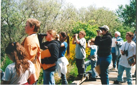
The Wildlife Refuge is located in eastern Grays Harbor, near the mouth of the Chehalis River. Shorebirds migrating from as far away as Argentina stop to rest and feed in Grays Harbor estuary every spring. Visitors are welcome to explore this extraordinary refuge. Learn more about the Grays Harbor National Wildlife Refuge here.
Mima Mounds Natural Area Preserve
Mima Mounds Natural Area Preserve (NAP), located in the northern extent of the Chehalis Watershed, was established in 1976 to protect rare examples of mima mound landforms and Puget prairie grasslands. The site includes a small Garry oak woodland and savannah and also supports a variety of prairie dependent butterflies and birds, and Douglas-fir forest. Visitors are welcome!
Black River Conservation Areas
Land along the Black River contains one of the largest remaining wetland systems in western Washington, with extensive areas of unique, undisturbed swamp, containing prime habitat for migratory birds and other wildlife. The Black River supports robust runs of chum, Chinook and coho salmon, in addition to steelhead and cutthroat trout. In comparison to the rest of the Chehalis River watershed, people are developing land within the Black River sub-basin at a rapid rate. Development in sensitive areas, such as the wetlands along the Black River, damages and disrupts nature’s benefits, including the natural purification of water and protection from floods. Capitol Land Trust and their members have conserved more than 2,000 acres in the Black River Watershed for wildlife and ecosystem services in perpetuity.
Around Grays Harbor
The Chehalis River flows all the way to the ocean, but first passes through the Grays Harbor Estuary. Grays Harbor offers lots of opportunities for exploration.
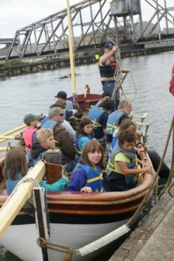
The Grays Harbor Historical Seaport , with its home base in Grays Harbor, offers sailings on the two tall ships, Hawaiian Cheiftan and Lady Washington. See their website for more information.
Interested in seeing the Chehalis River up close by boat? Contact the Polson Museum about a river tours by boat.

